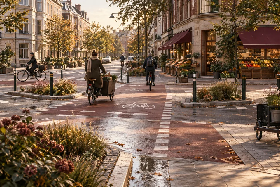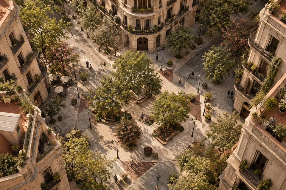
A completed street is an unusually convincing political object. New paving, trees and benches make change visible. A photograph can place yesterday’s traffic beside today’s public space and give the transformation a clean ending. Barcelona’s superblocks have become an international reference partly because that change is so legible.
The street’s work, however, begins again after the opening. People arrive with deliveries, children, mobility aids, bicycles and competing expectations. Trees need care. Residents need ordinary access. Businesses respond to a changed location. The project remains unfinished in this operating sense even when construction is complete.
That is a productive way to understand the model. It treats urban design as an ongoing allocation of space and opportunity, with a built form supporting choices that still have to be managed. The enduring question is who can move, pause and belong there, and what happens on the streets connected to it.
It also prevents the label from flattening Barcelona’s own history. A 2026 longitudinal study of the superblock concept describes changes in its spatial logic between 2015 and 2023, including the development of green axes and squares. The international shorthand covers an evolving program, rather than one design reproduced without modification across the city.
The diagram makes a claim about priorities
At its broadest, a superblock reorganizes movement to give more public space to people and less to through traffic. The significance is larger than a beautification scheme. It changes which activities the street makes easy and which journeys it asks to take another route.
Barcelona’s published design for Eixample’s green axes describes pedestrian priority, kerbless surfaces, planting, furniture and timed loading access. The document is a project description written ahead of the works, not a current audit of every feature. It nonetheless makes the intended trade-off clear: ordinary services remain part of the street, while their relationship to other uses changes.
That matters because “car-free” can be a misleading shortcut for a space with authorized vehicle access. The task is to define and manage access, speeds and expectations, not merely remove traffic from an illustration. A delivery vehicle entering a pedestrian-priority environment needs an arrangement different from a normal through route.
The plan also joins movement with staying. A street offers more than passage when people can sit, talk, play or wait without purchasing something. Benches and shade can make that invitation tangible. Their location and usability determine who receives it, rather than the number of objects listed in a construction contract alone.
This is why the street cannot be judged through one elegant overhead diagram. The diagram reveals an intention; use reveals how the intention meets a place. Both matter, and the second can expose a problem that the first makes difficult to see.
Consider an explicitly hypothetical crossing. A continuous surface improves movement for someone who struggles with a kerb. Another person needs a clear distinction between a pedestrian area and the path of an approaching vehicle. The design has to address both experiences. Removing a level change can help one task while creating another need for legible cues and management.
That is an argument for inclusive detail and observation, not against transformation. A city should expect a new public space to require adjustment. Treating every criticism as an attempt to restore the old traffic pattern makes it harder to improve the new arrangement for the people it is meant to serve.
The useful question is what happened, and where
Barcelona has investigated effects through its public-health agency. The Health in the Streets program evaluated interventions in Poblenou, Sant Antoni and Horta using several methods, including environmental measurements and residents’ experiences. It reports benefits in aspects such as tranquility, social interaction and environmental conditions in the areas examined.
The agency’s results infographic gives the differences some substance. In Sant Antoni it reports reductions of 25% in nitrogen dioxide and 17% in PM10 within the superblock. In Horta, those pollutants remained low without a detected change; black carbon fell significantly at one interior measurement point but increased at one main-street point. These are local measurements from an earlier evaluation, not a 2026 citywide result.
The same infographic records a less comfortable finding alongside Sant Antoni’s environmental gains: some families felt that the space conveyed more safety than the continuing car presence justified. Improved air and unresolved access management can coexist. The project becomes more useful to other cities when both results survive the summary.
The agency’s evaluation description identifies a nonexperimental before-and-after approach. That kind of study can provide valuable evidence while requiring care about other changes occurring over the period. The comparison’s design belongs in the interpretation, especially when urban conditions are changing for several reasons at once.
A 2025 discussion by Catalonia’s public-health agency explicitly notes the influence of the pandemic period on the evaluation. It also argues for building evaluation into planning. The practical lesson is to decide what evidence will be needed before the transformed street has already become the subject of a promotional story.
Different observations answer different questions. Lower measured noise is one result; a resident’s account of easier rest is another. More people pausing in a space is informative; it does not identify every person who can no longer use it. A useful evaluation retains several perspectives and investigates their differences.
The boundary matters too. A quieter transformed street may coexist with concerns on nearby routes. Traffic can change in amount, route or timing, and the outcome should be measured over a relevant area. Neither the assumption that every car is simply displaced nor the assumption that all inconvenience disappears is an adequate substitute for observation.
This broader account can improve the project. If a connected junction becomes difficult, the response might involve its operation or the wider network. A street-level intervention does not need to solve every mobility problem at once, but it should acknowledge the relationships through which its effects extend beyond the paving.
People use the space in ways the drawing did not schedule
Public space is valuable partly because its use cannot be fully scripted. A place intended for strolling can become a meeting point; a seating edge can attract an activity no designer predicted. The question is how the space accommodates that life without allowing some uses to exclude everyone else.
A 2026 study of Consell de Cent in Habitat International combines observations, interviews and documents to examine the relationship between design intentions and everyday use. Its attention to the street’s institutional and commercial setting widens the assessment beyond pedestrian counts.
The lesson for another city is to look carefully at the life arriving after the intervention. A crowd can signal popularity and create friction at the same time. A street can feel lively during one period and difficult for a nearby resident during another. Time of day is part of the place.
Commercial activity needs an equally careful account. A business able to benefit from more people spending time nearby may respond differently from one dependent on a particular delivery or access pattern. “Local commerce benefits” is an objective to investigate across actual businesses, rather than a result established by an appealing café photograph.
There is a distinction between public invitation and commercial occupation. A street can offer room to sit without paying, while terraces or other permitted activities consume part of that room. The allocation needs transparent rules and observation. Otherwise the space recovered from traffic can gradually become unavailable to the very public for whom it was recovered.
Maintenance decides how durable the invitation remains. Broken seating, neglected planting or unclear access can change how people use a street. A completed construction budget is therefore only part of the public commitment. The operating resources should remain visible after the opening ceremony has left the calendar.
Trees provide a particularly clear example of time. Planting is an event; establishing a healthy canopy is a continuing process. A plan can show future shade before the street actually supplies it. Residents experience the intervening seasons, including the need for appropriate shelter and care while the landscape develops.
The better evaluation follows that development rather than freezing the project at its most photogenic moment. It can ask what improves as planting matures, what deteriorates through wear and what rules need adjustment as uses change. That is a more demanding account of success, and a more realistic one.
Desirability needs a housing conversation
Improving a neighborhood can make it more attractive. The social ambition is stronger when existing residents can continue to benefit from that improvement. Public-space policy therefore has a relationship with housing and commercial tenure, even though paving cannot independently control either market.
It would be careless to attribute every price change around a redesigned street to the redesign alone. Cities experience several forms of demand and investment at once. A causal claim needs appropriate data and comparison. But uncertainty about the exact contribution is not a reason to ignore who can remain in the area.
A useful monitoring program can follow residential and commercial change alongside the street’s environmental results. Are ordinary services retained? Which groups are using the new space? Do residents report a more usable neighborhood while facing a less secure position within it? These questions keep the project’s civic purpose in view.
The answer may require other policy tools. Housing protections, affordability measures or rules for commercial use operate differently from traffic management. A city should not expect an urban-design intervention to deliver all of them as incidental effects. Coordination means recognizing the separate responsibilities and making them work together.
This also changes how another city should borrow the model. A 2025 international study using expert consultation and living labs in Vienna and Berlin examines the gap between superblock theory and practice. Its approach points toward adaptation in local settings rather than copying a Barcelona image and assuming the institutional conditions arrive with it.
Street form, transit, existing movement and local governance shape what a proposal can accomplish. The same geometric arrangement can distribute burdens differently in another place. Transferable principles are useful; a ready-made result is not available for import.
Completion is a continuing public commitment
A credible superblock program would give its opening photograph a future. It would specify the access arrangements, fund maintenance and observe environmental conditions and daily use. It would listen to people whose experience differs from the promotional account and investigate the surrounding network.
Its public reporting would retain both achievements and unresolved issues. More usable space and a problem at a delivery point can both be true. A quieter interior street and a concern on a boundary route can both merit attention. Learning from the latter need not cancel the former.
This is what makes the unfinished quality a strength when it is handled honestly. The city remains willing to adjust a functioning place, rather than defend a static design as if admitting a problem would undo the entire transformation. Public space is used continuously; its management should be capable of responding continuously too.
Barcelona’s most useful lesson is therefore more ambitious than replacing asphalt with trees. It is to treat the distribution of street space as a public decision that can be changed, evaluated and improved. The paving gives that decision a form. The people using it give the project its continuing test.
Sources & context
This article draws on the sources linked in the text. Analysis and illustrative scenarios are identified separately from reported findings.
- 2026 longitudinal study of the superblock concept
- published design for Eixample's green axes
- Health in the Streets program
- results infographic
- evaluation description
- 2025 discussion by Catalonia's public-health agency
- 2026 study of Consell de Cent in Habitat International
- 2025 international study using expert consultation and living labs in Vienna and Berlin